
|
Having founded Fort Pontchartrain in 1701, Antoine de La Mothe Cadillac and his initial group of settlers relied on deliveries of food supplies and other rations from the Quebec territories. The distance traveled between the two territories was virtually insurmountable, but was deemed necessary. Due to the proximity of competing Indian tribes on all sides of the new Fort, not enough land had been appropriated to grow crops. In addition, Cadillac had not been given approval to give the go-ahead for farm establishment.
|
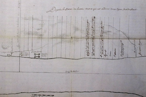
"Plan of Detroit" ribbon farms layout, north of Downriver, from 1731.
|
When finally able to do so in 1707, Cadillac issued a total of 31 farm grants in three years, for ribbon farms extending from Fort Pontchartrain (the future Detroit) southward toward the wooded Downriver area. Much more was to be expected in the ensuing years, but Cadillac was "promoted" to governor of the Louisiana territory in 1710. Therefore, between that time and 1730, the Detroit colony languished, as new permits were not issued.
|
Once King Louis XV was in power in the early 1730s, he encouraged established colonies like Fort Pontchartrain to become more self-sufficient, and began granting permits once again in the years following the Fox Wars, which ended in 1733. The southwestern boundary of these permits appeared to be the property line of the Huron Indian establishment. In 1738, an apparent dispute arose with the Ottawa Indian tribe, which caused the Hurons to abandon their village west of Fort Pontchartrain. This would encourage the establishment of future ribbon farms moving closer to the Downriver area near present-day Delray and River Rouge.
The takeover of Fort Detroit by the British in 1760, followed by Chief Pontiac's actions from 1763 onward, once again halted the progress of ribbon farm construction. Farm after farm would be abandoned by their original settlers. The influx of the white man encouraged transfer of deeds as well as redevelopment of land in the subsequent years. For example, Grosse Ile was purchased from the Potawatomi less than twenty years before the Macomb brothers signed the official deed to make Grosse Ile an eventual Township. |
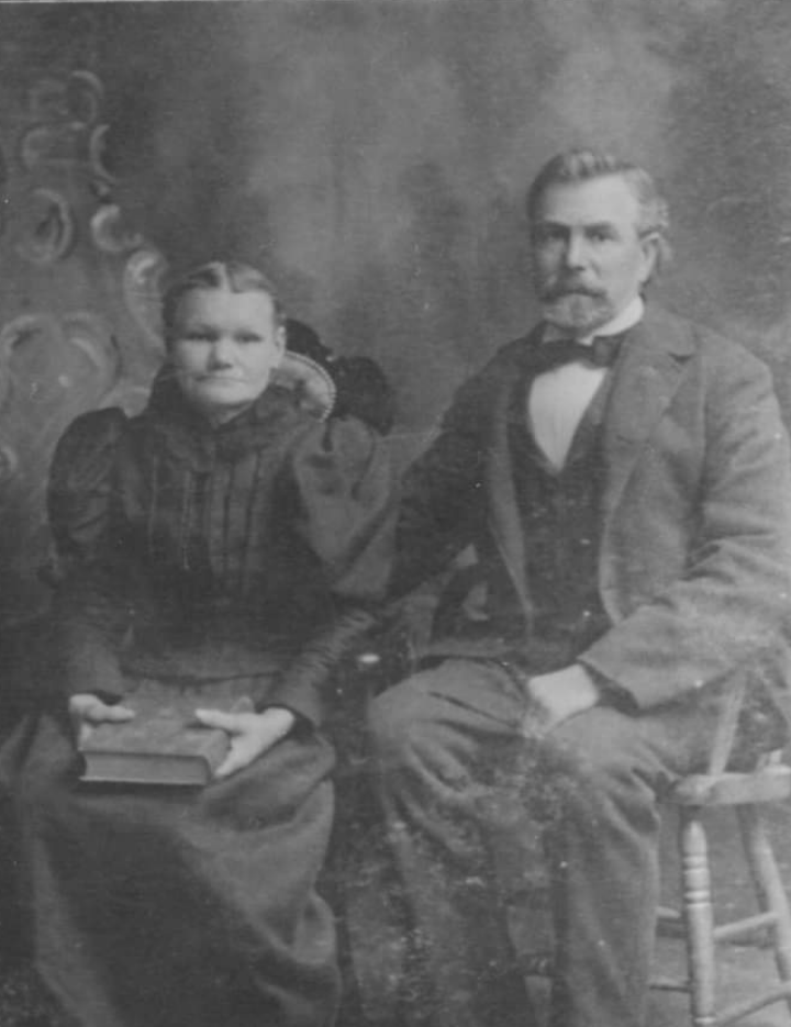
Augusta and John Heft, photographed in the 1850s. They had established a farm on the Riverview side of Pennsylvania Road just west of Grange.
|
During this space of time before the American Revolutionary War, these farms began to develop south through Downriver toward Lake Erie. In the case of areas around Delray and River Rouge, these farms began locating more inland.
|
The dawning of the 1800s brought some much-needed relief to some beleaguered farmers in the area. The Detroit Land Bank opened by 1804, which made the permit process much more manageable. In addition, according to previous declarations, the area of their farms had required that a wooded area in back of their properties not be touched, possibly to act as an official, unfenced property line. Farmers were able to successfully argue that they needed to service and harvest the woodlands for fuel, fence construction, and outbuildings. The United States Congress would pass a law in 1812 granting these farmers a literal doubling of their land holdings.
|
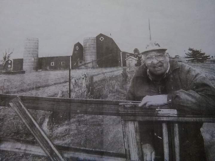
Lester Schafer helps call it a career for the Schafer Family farm in Southgate back in 2000. Mr. Schafer and his wife retired and moved to another location in Carleton.
|
Locally, this was the approximate time frame when many of the pioneering settlers in the Downriver area, with names such as Cicotte, Labadie, Salliotte and others began establishing their farms and families. Three others which will be profiled here carried last names of Heft, Koch, and Schafer.

According to Wikipedia, Ribbon Farms are defined as long, narrow land divisions which adjoin a body of water or road. In this area, they were considered a European descent. The initial farms in Detroit, when constructed in the 1700s, averaged 250 feet wide and three miles long.