

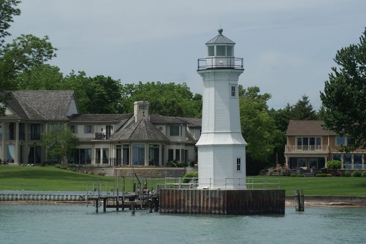
Grosse Ile North Channel Front Range Light
|
With the dawn of the Industrial Revolution by the 1870s, the Detroit River became a huge shipping point for trade, not just for neighboring Canada but other states bordering Michigan in the high Great Lakes area. Initially, shipping could only occur during the day, which led to the Cleveland Vessel Owners Association petitioning to have range lights installed through the Downriver section of the Detroit River in order to facilitate night-time shipping for steamboat traffic. This request was granted and by 1891, the first front and rear range light appeared on Hennepin Point.
|
That location was chosen to guide these ships past the sandbar off the southwest point of Fighting Island. These lights were designed to help up-bound traffic. In 1894, the United States Congress set funding aside to place another pair of lights to service traffic heading toward Lake Erie. This is where the Grosse Ile North Channel Front & Rear Range lights were commissioned, with their first date of service being July 16th. The location was chosen to identify the Fighting Island Channel north of Mamajuda Island.
The North Channel light erected by 1894 is not the structure seen today on the east end of the island. It more resembled a water tower on stilts and was constructed on wooden pilings along a 170 foot pier from the shore. The lighthouse underwent a total rebuild, and the present structure surfaced by 1906. The rear range light, which was actually taller, was located north of Horsemill Road near present-day Parke Lane.
The lifespan of the rear range light was only eighteen years. With the opening of the Livingstone Channel by 1912, and other waterways being dredged and straightened, the north channel itself would cease to exist, and that light was decommissioned and razed. Only in a few rare, early photographs can this lighthouse be viewed.
The North Channel Front Range Light (now simply known as Grosse Ile Lighthouse) was in active duty until 1963 when the lights were shut off and the lens removed. In 1965, with the assistance of the Grosse Ile Historical Society, the lighthouse was purchased for the sum of $350 by the Township from the Department of the Interior. It is funded strictly by private donation, with the majority coming from the Lighthouse Endowment Fund. Until recently, annual tours were given of this structure in September of each year.
Mamajuda Lighthouse
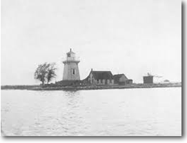
Mamajuda Lighthouse in an undated photo. (Wikipedia)
|
Pre-dating the first version of the North Channel lights by at least 30 years, the Mamajuda Lighthouse was constructed in approximately 1849 and rebuilt in 1866. The lighthouse keeper and family were the only residents of the island during this time. Erosion, as mentioned in the island entry below, contributed to the lighthouse being washed away by 1950. No record exists of its active service time.
|
Calf Island
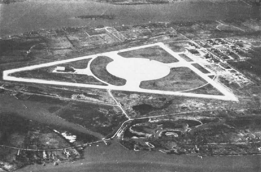
Calf Island can be seen in the upper background of this 1969 Grosse Ile Airport image. (Wikipedia)
|
The smallest of the islands in the Grosse Ile cluster which are actively visible, Calf Island comprises seven acres and has a surface elevation of 571 feet. It locates 1,000 feet off the southwestern tip of Grosse Ile.
It was added to the Detroit International Wildlife Refuge decree in 2002 whose duties include identifying waterfowl and fish that may be native or spawning to the area. To date, approximately 29 waterfowl and 65 breeds of fish have been seen here at Calf Island, which is also a nesting spot for herons. |
Celeron Island

|
A 130 acre swath of what actually constitutes four adjoining islands which may be seen during low water levels, Celeron Island is part of the Point Mouillee State Game area and, although located closer to Gibraltar, is monitored by the Township of Grosse Ile, which charts this as its southermost island. It is located about 1/4 mile east of Horse Island.
|
Edmond Island
This 35 acre parcel is located within the jurisdiction of Gibraltar, densely populated with one circular road of service, located only 20 feet from the mainland of the city. Another island, Cherry, is adjacent and is part of the Lake Erie Metropark directly south; however, since connected to the mainland of the metropark, Cherry Island is not actually an island.
Mamajuda Island
Mamajuda Island, smallest of the Detroit River islands.
|
The smallest island to be charted in the Detroit River's length, Mamajuda Island was just east of the tip of Hennepin Point opposite Wyandotte, and about 500 feet from the Canada border proper. Comprising just 30 acres at its above-ground peak, it fell victim to erosion from the somewhat swift river current and disappeared from view (and from the majority of subsequent maps) around 1960. When water levels are low, all that may be seen are a few scattered boulders, which can still pose a hazard for boaters.
|
